Hello, I am Ryan Monk, a technology specialist at CLAAS Harvest Centre Canterbury.
CLAAS Harvest Centre Canterbury is a leading provider of agricultural machinery in the South Island of New Zealand. Over the past 30 years, we have maintained successful partnerships with premium agricultural machinery manufacturers such as CLAAS, AMAZONE, JCB, Trioliet and Grimme. CLAAS Harvest Centre Canterbury is owned by Carrfields; a large family-owned company that has supply chains stretching across New Zealand and international markets.
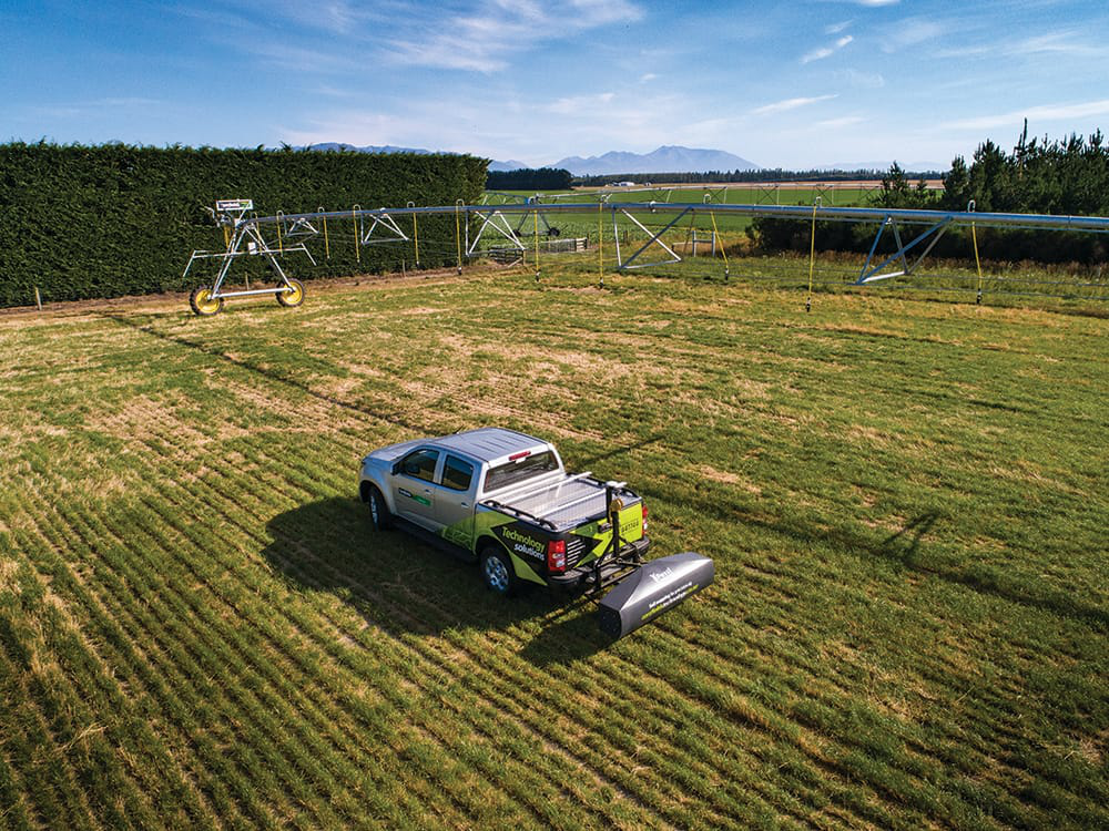
More recently, Carrfields has expanded its business and has formed a new agricultural technology division. As part of this expansion, Carrfields Technology has invested in precision soil mapping equipment that analyses variability in soil texture and water holding capacity. For this equipment, we required RTK positioning so that we can map with a high degree of horizontal and vertical accuracy. This allows us to return to any points-of-interest and also means that our end-customers, and irrigation designers, are receiving maps of the highest quality.
We have previously used the Tersus David and BX306 for other applications and decided that Tersus David would be a suitable option for the soil mapper. With this in mind, we ordered the Tersus David receiver and the Tersus GeoBee NTRIP modem. This offers a compact package that can connect to the comprehensive CORS network, which operates throughout New Zealand.
The Tersus equipment was installed into a survey vehicle in March 2019. The low-profile design of both units meant that they could be installed discretely under the driver’s seat. After installation, the David receiver was configured quickly, using a smartphone, to output NMEA data on the COM ports. The GeoBee was also configured with the local NTRIP settings. Both components have complimented each other well and we have had no issues with reliability or connectivity.
For our field survey applications, we have been using the David receiver in conjunction with the Tersus Nuwa smartphone app. The Bluetooth interface gives trouble-free connectivity with the smartphone and has provided reliable results in the field.

The Tersus GeoBee is a dedicated and cost-effective solution to transmit or receive Ntrip corrections. With Tersus Ntrip Caster Service, Ntrip Modem and David Receiver, the GeoBee opens the possibility for users to transmit Real Time Kinematic (RTK) corrections via Internet (Ethernet or 2G/3G/4G) in a simple, user-friendly way, just using a SIM card or Ethernet cable without any need of a static IP. GeoBee can also work as GNSS Rover to receive RTK corrections from Tersus Ntrip Caster or any CORS service.

For the full Use Case, please download here: https://www.tersus-gnss.com/use-case/david-receiver
CLAAS Harvest Centre Canterbury is a leading provider of agricultural machinery in the South Island of New Zealand. Over the past 30 years, we have maintained successful partnerships with premium agricultural machinery manufacturers such as CLAAS, AMAZONE, JCB, Trioliet and Grimme. CLAAS Harvest Centre Canterbury is owned by Carrfields; a large family-owned company that has supply chains stretching across New Zealand and international markets.
More recently, Carrfields has expanded its business and has formed a new agricultural technology division. As part of this expansion, Carrfields Technology has invested in precision soil mapping equipment that analyses variability in soil texture and water holding capacity. For this equipment, we required RTK positioning so that we can map with a high degree of horizontal and vertical accuracy. This allows us to return to any points-of-interest and also means that our end-customers, and irrigation designers, are receiving maps of the highest quality.
We have previously used the Tersus David and BX306 for other applications and decided that Tersus David would be a suitable option for the soil mapper. With this in mind, we ordered the Tersus David receiver and the Tersus GeoBee NTRIP modem. This offers a compact package that can connect to the comprehensive CORS network, which operates throughout New Zealand.
The Tersus equipment was installed into a survey vehicle in March 2019. The low-profile design of both units meant that they could be installed discretely under the driver’s seat. After installation, the David receiver was configured quickly, using a smartphone, to output NMEA data on the COM ports. The GeoBee was also configured with the local NTRIP settings. Both components have complimented each other well and we have had no issues with reliability or connectivity.
For our field survey applications, we have been using the David receiver in conjunction with the Tersus Nuwa smartphone app. The Bluetooth interface gives trouble-free connectivity with the smartphone and has provided reliable results in the field.
The Tersus GeoBee is a dedicated and cost-effective solution to transmit or receive Ntrip corrections. With Tersus Ntrip Caster Service, Ntrip Modem and David Receiver, the GeoBee opens the possibility for users to transmit Real Time Kinematic (RTK) corrections via Internet (Ethernet or 2G/3G/4G) in a simple, user-friendly way, just using a SIM card or Ethernet cable without any need of a static IP. GeoBee can also work as GNSS Rover to receive RTK corrections from Tersus Ntrip Caster or any CORS service.

GeoBee and David receiver mounted in the vehicle under driver’s seat
For the full Use Case, please download here: https://www.tersus-gnss.com/use-case/david-receiver
Comments
Post a Comment