DXF is a file format developed by AutoCAD for data exchange between AutoCAD and other software. In the actual measurement process, we often get files in DXF format. They may be design files, the planner first design the building facilities, road or bridges on the desktop software, and then the surveyors stake out the field based on the DXF design files and mark out the location of the feature points; they may be a mapping file, which is drawn by the surveyor according to the results of the previous object collection, and now it is necessary to add new object collection on the original basis, or inspect and verify the old objects.
As a good helper for surveyors, Nuwa app provides a variety of flexible application scenarios for these situations.
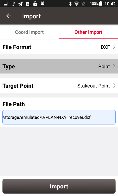
If you need to stake out the design feature points in the DXF file and mark the location of the feature points on the ground, you can import it in Nuwa app via Import -> Other import, select the DXF file and import the point data to the staking point library. Once you have completed the above steps, you can enter the point stakeout interface and stake out the points in the staking point library in order to mark each design point.
If you need to add new objects on the basis of the original objects, or you want to display the DXF file in your survey or stakeout interface as the background during the above staking out process, you can perform the following operations:
1) Place the DXF file in the TersusSurvey\Maps folder
2) Connect the Tersus GNSS receiver, enter the Survey or Stakeout interface
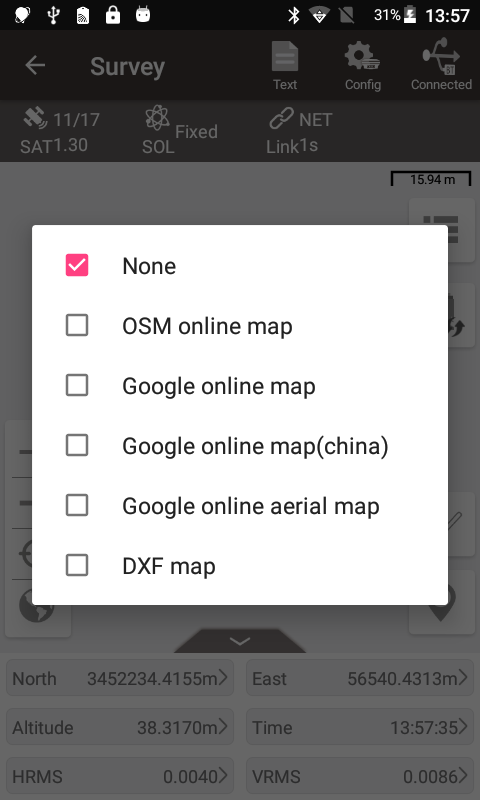
3) Click the map icon on the upper right, and then check DXF map.
4) The software will automatically read out the DXF files in the Maps folder and display them in the file list, check the DXF basemap files you expect to display.
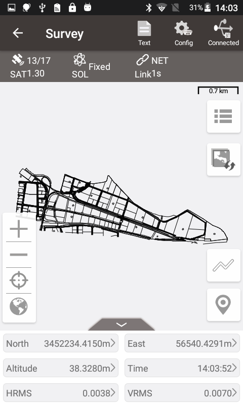
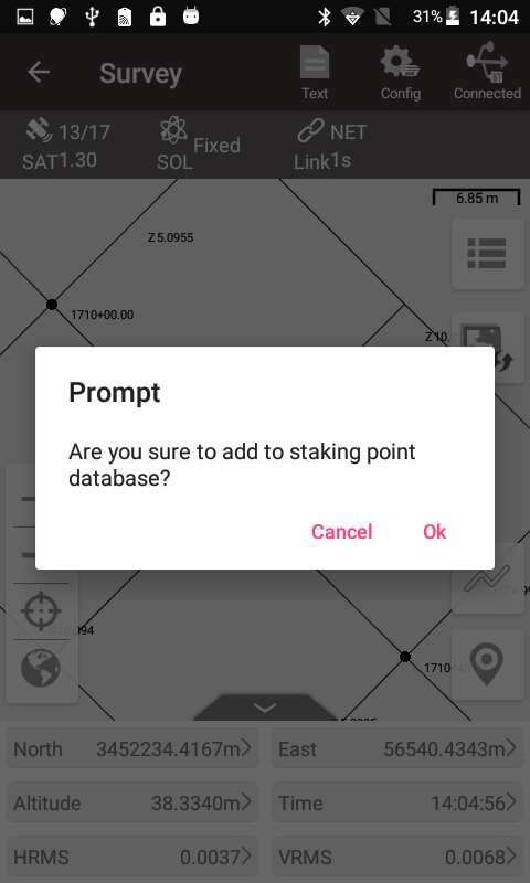
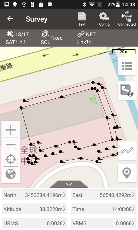
Back to the main interface of Survey or Stakeout, you can see that the DXF graphics have been displayed in the interface. Their display is just as they displayed in AutoCAD software. In addition, you can click on the points on the DXF basemap. It is also allowed to add them to the staking point library for the stake out operation.
On this basis, if you apply online map or online satellite map at the same time, both the DXF basemap and online map will be displayed in front of you at the same time. The overlap of the two maps is very high, basically with no error, as long as you choose the correct coordinate system. You can also use them as an auxiliary reference in your survey or stake out process. At this time, enjoy the intuitive feeling brought by the DXF basemap and online map!
As a good helper for surveyors, Nuwa app provides a variety of flexible application scenarios for these situations.
If you need to stake out the design feature points in the DXF file and mark the location of the feature points on the ground, you can import it in Nuwa app via Import -> Other import, select the DXF file and import the point data to the staking point library. Once you have completed the above steps, you can enter the point stakeout interface and stake out the points in the staking point library in order to mark each design point.
1) Place the DXF file in the TersusSurvey\Maps folder
2) Connect the Tersus GNSS receiver, enter the Survey or Stakeout interface
3) Click the map icon on the upper right, and then check DXF map.
4) The software will automatically read out the DXF files in the Maps folder and display them in the file list, check the DXF basemap files you expect to display.
Back to the main interface of Survey or Stakeout, you can see that the DXF graphics have been displayed in the interface. Their display is just as they displayed in AutoCAD software. In addition, you can click on the points on the DXF basemap. It is also allowed to add them to the staking point library for the stake out operation.
Comments
Post a Comment